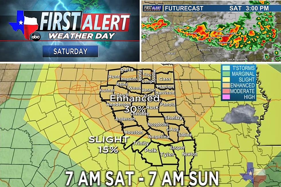
Hail And Strong Winds Could Potentially Punish East Texas Late Tonight

East Texas could experience another round of severe weather late tonight into early Wednesday morning and continue through tomorrow's drive into work. In addition to heavy rain at times, we could experience high winds along with some large hail. At this point tornado and flash flooding risks are low, but they can't be ruled out.
It was a week ago that we experienced numerous tornado warnings with several touchdowns causing damage throughout East Texas. KLTV 7 Meteorologist Katie Vosler feels that the tornado threat isn't as great with this storm system as it was last week, but the possibility is still there.

The southerly winds are blowing pretty good this afternoon bringing in a lot of moisture from the Gulf of Mexico. Much of East Texas is under a wind advisory through 7 Wednesday morning. The Storm Prediction Center has placed much of East Texas under a marginal or slight risk for severe storms during this event.

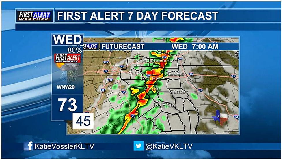
This line of storms will begin to form around midnight across the Dallas/Ft. Worth area and begin marching eastward. The bulk of the storms are expected to be in the heart of East Texas right around 7 a.m. to 8 a.m. These storms could produce wind gusts in excess of 70 m.p.h. and produce hail up to the size of a quarter.

Once the squall line of storms moves through, the skies will clear and be a bit cooler Wednesday afternoon but will remain breezy throughout the afternoon.

In the event of severe weather, we will keep you updated from the First Alert Weather Center at KLTV 7 and in the event that a tornado warning is issued for East Texas we will join weather coverage from KLTV 7. Make sure that your cell phone or tablet is charged and that you have our app on your device to stay connected and informed.
As the storm system marches through Louisiana into Mississippi throughout Wednesday, the risk of severe weather increases.
KEEP READING: What to do after a tornado strikes
KEEP READING: Get answers to 51 of the most frequently asked weather questions...
LOOK: The most expensive weather and climate disasters in recent decades
Gallery Credit: KATELYN LEBOFF
TIPS: Here's how you can prepare for power outages
More From 107-3 KISS-FM