Barry Threatens Flooding to Some Gulf States
Barry continues to bring the threat for heavy rain, storm surge, flooding and gusty winds to some gulf states.
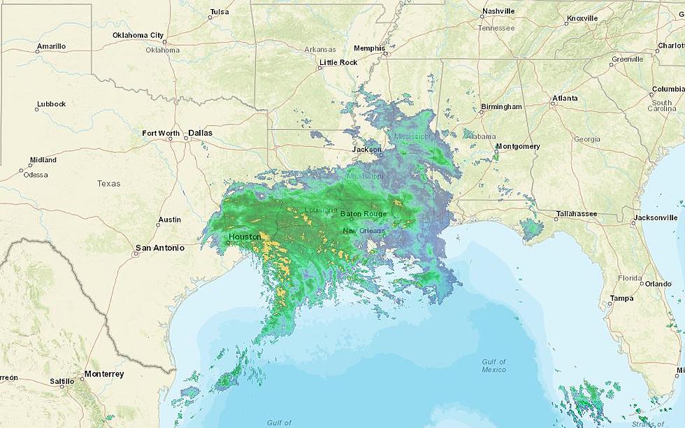
Barry reached tropical storm strength early Thursday and could become a Category 1 hurricane before making landfall early Saturday. Once it moves onshore it’s expected to weaken rather quickly.
The forecast from the National Hurricane Center indicates the storm's center of circulation will stay east of East Texas, however, a small shift in the storm's track could mean heavy rain and some gustier winds for us. But for now, it looks like the heavy rains will be in eastern Louisiana and Mississippi. Areas closer to the Louisiana state line could see up to an inch of rain through early next week as this storm skirts by.
This more recent forecast is a bit of relief for East Texas, as earlier model runs had us seeing closer to 3 to 4 inches of rain. But the track has since shifted east and that means we’re on the dry side and the less impactful side of this storm.
Barry is expected to weaken to a tropical depression early Sunday as it passes by East Texas, and from there move north through Arkansas, Missouri, Illinois, and Indiana.
Barry is the second named storm of the 2019 Atlantic Hurricane Season, but the first that moved into the Gulf of Mexico. Subtropical Storm Andrea formed May 20th and lasted one day, but was well out in the Atlantic Ocean. Barry will also be the first storm of the season that will impact the mainland U.S.
More From 107-3 KISS-FM